Left Bardstown, KY and drove east across Kentucky toward Huntington, WVA. We passed several immaculate horse farms—beautiful pastures defined by either tidy white or dark brown board fencing. Gently rolling hills. These old farms used to be family-owned but are now owned by corporations or foreign investors. End of an era.
So far, all interstates we’ve travelled on have been REALLY rough!! No money is being spent on highway maintenance!! So tough on us, the motorhome and our dog, Dixie. The motorhome was her first home so she travels well. However, when we hit a rough noisy patch of road, Dixie goes airborne from her chair to my feet! So, up she comes into my lap for some reassurance. Being a rat terrier, she has large ears, built for hearing varmints. This makes her sensitive to any loud noises—they’re amplified. Once the worst is over, she returns to her seat until the next scare!
NOTE: We recommend driving the Bluegrass Parkway from Bardstown to Lexington—beautiful.
Made it around Lexington and east on I-64 to Huntington. The next segment of our trip will be far more restful. We’ve decided to explore the Ohio River Scenic Byway as we head upriver. Our pace will now be more relaxed and we can enjoy the scenery. Might even post some photos!!
1,657 miles driven so far.
Wednesday, May 23, 2012

“Maritimes 2012”–Wednesday, May 16
Woke to find three high-end Prevost motorhomes parked next to us at the Jackson, TN, Sam’s Club. Possibly they were in transport, since their bumpers had stickers mentioning a leasing company. Anyway, we enjoyed the humor of being parked for the night next to expensive Prevosts in a Sam’s parking lot!
We haven’t taken any photos yet since we’re not sight-seeing exactly. We’re traveling mainly on interstates until we get further north. Bear with us—photos will be included later!
Things for which I’m grateful:
I’d spotted the fine hamlet of “Only” on our Tennessee map—it was very close to our route so I just added it as a brief stop. I mean, why not? Life is short. Well, sadly, we couldn’t visit Only. the road in was too narrow for our motorhome. If only we’d been traveling with just our truck, we’d have satisfied our curiosity!
Next place name which caught my attention was the community of “Bucksnort”. A tavern in Richard’s hometown of Colfax, WI, has this same name! Always makes us laugh! Didn’t stop today; just enjoyed the name as we passed by.
Our lunch stop was at a rest area just inside the KY state line on I-65. Very pleasant! Ironically, a truck parked right next to us was from Nuevo Leon, MX, a state in Mexico located right below the border from where we live. It was carrying steel gearbox blanks.
As we neared Bowling Green, KY, we spied a sign for a Camping World store. (CW’s corporate headquarters are located in Bowling Green.) We needed to purchase a replacement heavy duty sewer hose for our motorhome so peeled off the interstate and wound our way back towards the store. Lo and behold, it was located side-by-side with a Gander Mountain Outdoor Sports store—I felt like I’d hit the big time!! Two “toy” stores in one!! Bought a few things at Gander Mtn. and our sewer house at CW, then off we went. What a serendipitous stop!
Stayed the night at a WalMart in Bardstown, KY. We were greeted by a VERY happy-sounding mockingbird in the tree by our parking place. He stayed happy during the evening, too. Made me homesick for the mocking-birds in Retama!
We haven’t taken any photos yet since we’re not sight-seeing exactly. We’re traveling mainly on interstates until we get further north. Bear with us—photos will be included later!
Things for which I’m grateful:
1) Sirius satellite radio;At a rest area during today’s drive, I noticed a sign: “No unloading of livestock.” What??? OK, the grass was very green and lush there but I still found it amusing. Only one like it I’ve ever seen.
2) our Garmin nuvi LM50 GPS;
3) our faithful now-7-years-old Newmar Dutch Star motorhome;
4) my husband, Richard—his generous spirit, his many “fix-it” skills, his love for our dog and willingness to walk her multiple times each day (for the moment, I’m not physically able to) even when he may not want to;
5) my temporary “Handicapped” placard, which means I don’t have to walk as far or as long. Yes, my goal is that it is a temporary placard!!
I’d spotted the fine hamlet of “Only” on our Tennessee map—it was very close to our route so I just added it as a brief stop. I mean, why not? Life is short. Well, sadly, we couldn’t visit Only. the road in was too narrow for our motorhome. If only we’d been traveling with just our truck, we’d have satisfied our curiosity!
Next place name which caught my attention was the community of “Bucksnort”. A tavern in Richard’s hometown of Colfax, WI, has this same name! Always makes us laugh! Didn’t stop today; just enjoyed the name as we passed by.
Our lunch stop was at a rest area just inside the KY state line on I-65. Very pleasant! Ironically, a truck parked right next to us was from Nuevo Leon, MX, a state in Mexico located right below the border from where we live. It was carrying steel gearbox blanks.
As we neared Bowling Green, KY, we spied a sign for a Camping World store. (CW’s corporate headquarters are located in Bowling Green.) We needed to purchase a replacement heavy duty sewer hose for our motorhome so peeled off the interstate and wound our way back towards the store. Lo and behold, it was located side-by-side with a Gander Mountain Outdoor Sports store—I felt like I’d hit the big time!! Two “toy” stores in one!! Bought a few things at Gander Mtn. and our sewer house at CW, then off we went. What a serendipitous stop!
Stayed the night at a WalMart in Bardstown, KY. We were greeted by a VERY happy-sounding mockingbird in the tree by our parking place. He stayed happy during the evening, too. Made me homesick for the mocking-birds in Retama!
“Maritimes 2012” – Tuesday, May 15
Pleasant daytime temperatures here in Arkansas, and cooling each evening—a refreshing change from late spring in the Rio Grande Valley of TX where we live! It’s consistently in the 90’s by day-70’s at night down there already.
Today, we left Hot Springs, bound for parts north. Our day’s trek took us past rice fields e. of Little Rock, AR, many having the funny little cone-shaped crawfish (“mud bug”) traps placed in even rows throughout. A happy second source of income for the rice farmers! These are also commonly seen in Louisiana and east TX.
The countryside is SO green, with thick woodlands and wind-rows. So refreshing!
After a fuel stop in West Memphis, AR, we continued on to spend the night in a Sam’s Club parking lot in Jackson, TN. (Wow, are we grateful for our new blinds, particularly the night shades—complete blackout so no parking lot lights! Yay!!) The WalMart next door directs RVers to the Sam’s Club lot since Sam’s closes for the night. The WalMart here remains busy at all hours.
We’ve driven 1,130 miles since leaving home. I think I’ll note our mileage in each post just for fun. Somebody out there might be interested!
Today, we left Hot Springs, bound for parts north. Our day’s trek took us past rice fields e. of Little Rock, AR, many having the funny little cone-shaped crawfish (“mud bug”) traps placed in even rows throughout. A happy second source of income for the rice farmers! These are also commonly seen in Louisiana and east TX.
The countryside is SO green, with thick woodlands and wind-rows. So refreshing!
After a fuel stop in West Memphis, AR, we continued on to spend the night in a Sam’s Club parking lot in Jackson, TN. (Wow, are we grateful for our new blinds, particularly the night shades—complete blackout so no parking lot lights! Yay!!) The WalMart next door directs RVers to the Sam’s Club lot since Sam’s closes for the night. The WalMart here remains busy at all hours.
We’ve driven 1,130 miles since leaving home. I think I’ll note our mileage in each post just for fun. Somebody out there might be interested!
“Maritimes 2012” – Saturday, May 12-Monday, May 14, 2012
Our next destination was the Malvern-Hot Springs, AR, area to see our good friends, Larry and Sharon Thoresen, who are also our neighbors at home in Retama Village, Mission, TX. As soon as we were parked at the Cloud Nine RV Park, Larry and Sharon picked us up (including our “Miss Dixie” dog) to dine on burgers back at their house. And what a lovely home it is!! Really large to accommodate Sharon’s parents’ visits (they have their own bedroom, bath, and sitting room), and it’s such a welcoming home indeed. Larry and Sharon have many beautiful antiques and mementos. We had a wonderful evening, catching up with each other, dining on delicious burgers, brats, salads, and fresh fruit, and Dixie enjoyed playing with her buddies, Milo and Lady Bug, the Thoresen’s two cocker spaniels. What a wonderful time!
Continuing the festivities, the next day Sunday 5/13 was “Mother’s Day”. The Thoresen’s picked us up and took us to the Hotel Arlington in Hot Springs for Sunday brunch. It was elegant, bountiful, delicious, and the four of us naturally over-ate! After lunch (and to prevent us all from becoming comatose!), we wandered down a block or two to tour the Fordyce Bathhouse Museum on Bathhouse Row. Fascinating! Many of the bathhouses are to be restored. The Buckstaff is the only one already restored and functioning as a traditional bathhouse. Others, also restored or renovated, now contain more modern “spa”-type businesses while maintaining much of the buildings’ original character inside. All of the restorations have to be done according to strict National Park Service guidelines.
There are “water stations”, public access mineral water fountains throughout the Bathhouse Row area, though an additional number have had to be capped off. We also drove out to look at Lake Hamilton, a nearby summer destination—resorts, boating, fishing, and other recreation.
The whole city of Hot Springs is a National Park! Discover more at this link Hot Springs National Park. It has a rich and colorful past: the mineral waters historically have been a real draw (said to alleviate the symptoms of or cure any number of ailments!), many film stars and other popular figures often visited here, and it was also renown for being a gangster-era hang-out in the 1920-30’s. We barely scratched the surface of it and would love to return.
Our respective “schedules” the next day, Monday 5/14, didn’t work out so said fond farewells to the Thoresen’s by phone and readied ourselves for the road. Later, Richard and I drove back into town for dinner at “On the Border”, then filled 3 gallon jugs with mineral water at the water station nearest the Arlington Hotel, where we’d had Sunday brunch.
Continuing the festivities, the next day Sunday 5/13 was “Mother’s Day”. The Thoresen’s picked us up and took us to the Hotel Arlington in Hot Springs for Sunday brunch. It was elegant, bountiful, delicious, and the four of us naturally over-ate! After lunch (and to prevent us all from becoming comatose!), we wandered down a block or two to tour the Fordyce Bathhouse Museum on Bathhouse Row. Fascinating! Many of the bathhouses are to be restored. The Buckstaff is the only one already restored and functioning as a traditional bathhouse. Others, also restored or renovated, now contain more modern “spa”-type businesses while maintaining much of the buildings’ original character inside. All of the restorations have to be done according to strict National Park Service guidelines.
There are “water stations”, public access mineral water fountains throughout the Bathhouse Row area, though an additional number have had to be capped off. We also drove out to look at Lake Hamilton, a nearby summer destination—resorts, boating, fishing, and other recreation.
The whole city of Hot Springs is a National Park! Discover more at this link Hot Springs National Park. It has a rich and colorful past: the mineral waters historically have been a real draw (said to alleviate the symptoms of or cure any number of ailments!), many film stars and other popular figures often visited here, and it was also renown for being a gangster-era hang-out in the 1920-30’s. We barely scratched the surface of it and would love to return.
Our respective “schedules” the next day, Monday 5/14, didn’t work out so said fond farewells to the Thoresen’s by phone and readied ourselves for the road. Later, Richard and I drove back into town for dinner at “On the Border”, then filled 3 gallon jugs with mineral water at the water station nearest the Arlington Hotel, where we’d had Sunday brunch.
“Maritimes 2012” – Introduction (Yup, we’re on our way!!)
Despite several folks laying bets to the contrary, we actually did depart on Saturday, May 5, 2012! This latest adventure is a motorhome trip from our house in deep south Texas up to explore the Canadian Maritimes (New Brunswick, Nova Scotia, Newfoundland) for the summer. This will likely be our last major motorhome expedition. Future RV trips will be of both shorter distance and scope.
I hope to keep this blog up to date. Problem is, I find I’m better at “doing” the trip, rather than “writing” about it! Evening comes and I’m plum tuckered out. So, I hereby promise to be more disciplined. Many of our friends have asked that I post pictures to Facebook, but not all of our family or friends use Facebook. This blog seems to cover everyone! (Is there anyone without Internet access?? Really?? Very few indeed!!) I’ll post links to each installment on FB.
I hope to keep this blog up to date. Problem is, I find I’m better at “doing” the trip, rather than “writing” about it! Evening comes and I’m plum tuckered out. So, I hereby promise to be more disciplined. Many of our friends have asked that I post pictures to Facebook, but not all of our family or friends use Facebook. This blog seems to cover everyone! (Is there anyone without Internet access?? Really?? Very few indeed!!) I’ll post links to each installment on FB.
Sunday, May 20, 2012
“Maritimes 2012” – Saturday, May 5-Friday, May 11, 2012
[Our travel style is about 5-6 hours a day on the road. Our “sweet spot” for best fuel economy is about 62 mph. Thus, we usually cover only about 200-250 miles a day. Some RVers (including us) joke about belonging to the “Two or Two Club”—drive 200 miles a day and/or be off the road by 2pm! We tend to get a later start than most folks, yet are off the road by about 4 or 5pm. By the way, regarding favored departure times, there’s the 7-7:30am wave, the 9-9:30 wave, and then the “what’s-the-rush” wave, to which we belong, that leaves at about 11am, despite vague desires to leave earlier!]
Accordingly, this time, we departed from our home in Retama Village, Mission, TX, at the “crack” of 12 Noon!! Well, we made it anyway! One year, we didn’t leave until 4:30pm—made it to the Wal-Mart exactly two hours north in Falfurrias, TX!! Could have waited until the next day but we wanted to get on the road!!]
Our first night on the road this trip was spent dry-camped at the WalMart Super Center in Schertz, TX, n.e of San Antonio. It was an extremely hot evening so we’d opened most of our windows, grateful for the breeze. At 3 in the morning, I awoke to dramatic thunder/lightening, and rain drumming on the rooftop. By the time I could close the windows, wind-driven rain had come in all the windows along one side. I mopped up and returned to bed, glad I’d caught it just in time—my poor exhausted husband slept through the whole thing! Luckily, the storm cooled the air and the remainder of the night was more bearable (and quieter!).
We truly enjoy dry-camping, or parking with no hook-ups (electricity, water, or sewer). On our RV’s roof are four 100-watt solar panels which generate electricity that’s stored in our bank of six 6V deep cycle golf cart batteries. This allows us to live very comfortably; we simply don’t need hook-ups. Our lifestyle is seamless, hook-ups or not. There are 2 things for which we need our generator: running the microwave or the air conditioners. Also, it replenishes our batteries when there’s a cloudy day and we can’t receive a sufficient solar charge.
Our first destination this trip was MCD Innovations, in McKinney, TX, a suburb n.e. of Dallas. MCD makes window shades for RV’s—day shades which allow you to look out but prevent the sun and anyone outside from peeking into your RV, and night shades which are essentially “black out” shades preventing unwanted light from penetrating your RV and offering total privacy at night. All RVers have dealt with “the-parking-lot-light(s)-from-Hell” beaming into their RV and preventing a good night’s sleep. These new shades will take care of that problem!! (Wish we’d had them at the WalMart in Schertz!)
Arriving on Sunday 5/6, we spent 5 full days at MCD selecting which windows were to get shades, making a fabric choice for the night-time shades, getting the windows measured, and then, while our order was in fabrication, using this time to stow any gear which hadn’t found a “home” before we left, various chores, and doing some paperwork catch-up. The weeks leading up to our departure had been quite stressful and tiring, so we really appreciated this chance to catch our breath. McKinney is a lot larger than we’d anticipated—pretty impressive community. And MCD is a family-owned and operated company, striving to provide excellent products and service while being as “green” as possible. It’s remarkable how much material they efficiently saved from the landfill! They practice an active recycling program as well (i.e. scrap aluminum). We enjoyed our company tour.
Finally, on Friday 5/10, our turn in line arrived—it was “Installation Day”!! It proved to be a long one—there were a couple of hiccups—but they got ‘er done. We’re really satisfied with our new blinds and would happily recommend MCD to everyone!
Oh, and the nighttime black-out blinds?? They’re perfect!! (I’m writing this on May 20: they’ve been tested these past seven nights—1 RV park for 3 nites, one night each in 2 Wal-Marts, 1 Sam’s Club, and now a racetrack/casino parking lot.) This was a good choice and money well-spent.
Accordingly, this time, we departed from our home in Retama Village, Mission, TX, at the “crack” of 12 Noon!! Well, we made it anyway! One year, we didn’t leave until 4:30pm—made it to the Wal-Mart exactly two hours north in Falfurrias, TX!! Could have waited until the next day but we wanted to get on the road!!]
Our first night on the road this trip was spent dry-camped at the WalMart Super Center in Schertz, TX, n.e of San Antonio. It was an extremely hot evening so we’d opened most of our windows, grateful for the breeze. At 3 in the morning, I awoke to dramatic thunder/lightening, and rain drumming on the rooftop. By the time I could close the windows, wind-driven rain had come in all the windows along one side. I mopped up and returned to bed, glad I’d caught it just in time—my poor exhausted husband slept through the whole thing! Luckily, the storm cooled the air and the remainder of the night was more bearable (and quieter!).
We truly enjoy dry-camping, or parking with no hook-ups (electricity, water, or sewer). On our RV’s roof are four 100-watt solar panels which generate electricity that’s stored in our bank of six 6V deep cycle golf cart batteries. This allows us to live very comfortably; we simply don’t need hook-ups. Our lifestyle is seamless, hook-ups or not. There are 2 things for which we need our generator: running the microwave or the air conditioners. Also, it replenishes our batteries when there’s a cloudy day and we can’t receive a sufficient solar charge.
Our first destination this trip was MCD Innovations, in McKinney, TX, a suburb n.e. of Dallas. MCD makes window shades for RV’s—day shades which allow you to look out but prevent the sun and anyone outside from peeking into your RV, and night shades which are essentially “black out” shades preventing unwanted light from penetrating your RV and offering total privacy at night. All RVers have dealt with “the-parking-lot-light(s)-from-Hell” beaming into their RV and preventing a good night’s sleep. These new shades will take care of that problem!! (Wish we’d had them at the WalMart in Schertz!)
Arriving on Sunday 5/6, we spent 5 full days at MCD selecting which windows were to get shades, making a fabric choice for the night-time shades, getting the windows measured, and then, while our order was in fabrication, using this time to stow any gear which hadn’t found a “home” before we left, various chores, and doing some paperwork catch-up. The weeks leading up to our departure had been quite stressful and tiring, so we really appreciated this chance to catch our breath. McKinney is a lot larger than we’d anticipated—pretty impressive community. And MCD is a family-owned and operated company, striving to provide excellent products and service while being as “green” as possible. It’s remarkable how much material they efficiently saved from the landfill! They practice an active recycling program as well (i.e. scrap aluminum). We enjoyed our company tour.
Finally, on Friday 5/10, our turn in line arrived—it was “Installation Day”!! It proved to be a long one—there were a couple of hiccups—but they got ‘er done. We’re really satisfied with our new blinds and would happily recommend MCD to everyone!
Oh, and the nighttime black-out blinds?? They’re perfect!! (I’m writing this on May 20: they’ve been tested these past seven nights—1 RV park for 3 nites, one night each in 2 Wal-Marts, 1 Sam’s Club, and now a racetrack/casino parking lot.) This was a good choice and money well-spent.
Wednesday, June 30, 2010
Alaska 2010 – June 7-9: Great Falls to Fort Macleod, AB, Canada
We were up early and drove over to Whalen Tire Inc. to have the torque checked on all our lug nuts. (We’d purchased our new tires from them just 2 weeks before.) They kindly checked the ones on our truck, too, even though we’d bought those at Sam’s Club at about the same time.
Whalen’s service is very good and we were done in no time. Off we went up I-15 toward Shelby, MT, and up to the Canadian border at Sweetgrass! We made a pit stop en route and enjoyed seeing the wind ripple through the roadside grass and in the adjacent field. The Sweetgrass Hills of Montana are beautiful. Per my spouse Richard, the wind up here is called a “Great Falls Breeze”!
There were only a half dozen vehicles in front of us as we approached the border and they moved through at a good clip. When we pulled up to the guard’s booth, he first asked for our passports. We wondered if we’d be the “random” search vehicle so were VERY relieved when asked us only 5 more things:
- How long would we be staying in Canada?
- Were we carrying any tobacco, alcohol?
- Were we carrying any firearms, mace, or pepper spray?
- Had either one of us ever been in trouble with the law?
- Were we carrying anything which we would be giving away, selling, or discarding while staying in Canada?
(We’d been advised not to wear sunglasses so our eyes could be seen at all times and to answer each question as asked. When asked if you’re traveling with any cigarettes, answer simply “Yes” or “No”. Don’t say you don’t smoke. That wouldn’t stop a person from transporting them for someone else!)
We weren’t asked about any food products. We weren’t asked if we had any pets with us, so I asked if he wished to see our dog’s Health Certificate. He replied, “Is it rabid?” I replied, “Highly unlikely!” We must have answered everything to his satisfaction because he waved us through! Go figure!
Our mileage at the Canadian border: 31,650. We’d traveled 2,268 miles from our home in Texas!
Just on the other side of the border is a “roadside turn-out” (Canadian for “pull-off” or “picnic area”) so we made our lunch stop there. Conveniently, there’s a “Welcome to Alberta” sign and a token elk herd in a fenced pasture next door. Our first photo op’s in Canada! Unfortunately, the camera gremlins “ate” my photo of the Alberta sign (yes, it was really there!) yet saved the ones on either side of it—go figure!


We proceeded north toward Lethbridge and on to the next town, Fort Macleod. Obviously, the farther north we travel, the later spring arrives. So, we were still seeing a mix of spring green and winter tan on the rolling hills of the Canadian prairies. Grain storage silos in farm lots, well-planned wind breaks around each home, and full-size grain elevators in each of the town.
Lethbridge is a big city, full of all the amenities you could need. Gold’s Gym, Safeway, Boston Pizza, and many more! Just west of Lethbridge, we got to see the Canadian Rockies for the first time. (The lighting wasn’t good for a photo. Hey, I don’t want to bore you with TOO many gorgeous mountain shots! I figured Banff and Jasper would fill that bill!)
We were pleased to see two more wind farms sprinkled between Lethbridge and Fort Macleod.
Our destination for the next couple of days was Buffalo Plains RV Park & Campground, just n.w. of Fort Macleod. It’s located about a mile shy of Head-Smashed-In Buffalo Jump, our reason for stopping here.
The RV park is small, clean, quiet, and the views from here alone are worth the visit! You can see the prairies, the Oldman River Valley, the Porcupine Hills which contain the Jump, and the Canadian Rockies. There are sweeping views in all directions!
Head-Smashed-In Buffalo Jump is the site local aboriginal people used to herd bison off a sharp sandstone cliff to their death below. This entailed a massive cooperative effort between different bands of these people and could feed all of them for many months. We’d heard of this through television programs but wanted to see one for ourselves.


A partial view of a wind farm in the distance. (Alberta’s known for its prairie winds!)

The clump of trees in the center of the photo below is our RV park. This shows our view from there to the Jump is very good.

A passing rain shower out on the prairie.

And, finally for this stop on our journey, views from our RV park of the mountains…

the sky after a storm…

and a cloud over the prairie…

Friday, June 11, 2010
Alaska 2010 - June 3 and 4: Great Falls, MT
We kept working on our chores. It’s good to stay put now and then, take care of business, get caught up. But we’re eager to move north!
Thursday, June 3, there was a knock at our door. A pleasant couple asked if we were friends of Mark and Dortha Hall. We answered, “Yes”; the couple introduced themselves as Rod and Debbie Kendall. The Hall’s had told them they might cross paths with us since we were all headed in the same direction—Alaska. The Hall’s then gave the Kendall’s a brief description of our rig, and the address of our blog, which Debbie read. The Kendall’s checked into Dick’s RV Park, drove to their parking site, started to set up camp, turned, saw our rig directly behind them, and couldn’t believe their eyes!! What were the chances of this happening: same park, same nights, parked directly across the driveway from each other! This happens so often in our RV lifestyle and never ceases to delight me!!

We visited during that afternoon and then the four of us went out to eat at the Mongolian BBQ restaurant in town. Good dinner followed by Baskin Robbins ice cream. A perfect evening with new friends!!
This shows how close we’re parked to each other. That’s our motorhome and Dakota in the background at the left:

Friday, June 4, we each did our own thing then gathered late afternoon. At dinnertime, we went to “Boston”, a pasta/pizza place in town. Very good! Glad we chose this one! After dinner, we went to their rig and watched a DVD by Joe and Vicki Kieva about driving up the Alaska Highway and travel in Alaska.
Initially our paths will differ but we may be able to meet up along the way. Chances are we’ll be bumping into each other all summer—there aren’t that many roads in Alaska! They leave tomorrow, Saturday June 5, to visit friends outside of Calgary, AB—a 2-day trip from here. We hope to leave on Monday, June 7, bound for Ft. Macleod, AB, for a couple of days.
Another pleasant evening and this was our final gift:

Alaska 2010 – May 23-June 7: Great Falls, MT
Our first night in Great Falls (Sunday 5/23) was spent dry-camped across the street from Whalen Tire, Inc., where we would purchase 6 new tires for our motorhome on Monday, 5/24. We were very impressed with the service we received and the price. The boys had the tires installed by late morning of Monday, 5/24, so off we went to Dick's RV Park, here in Great Falls, where we stayed until we left for Canada. Dick’s is THE staging location for everyone crossing at Sweetgrass, MT, into Alberta. We were all Alaska-bound, except for a few “seasonal” residents! RV caravans also use this park as the last stop before heading north. Whalen’s suggested we return the morning of our departure to have the torque on the lug nuts all checked: motorhome & truck.
Montana has no state sales tax. This is why we scheduled this major tire purchase here. We also bought 4 new tires for our truck at Sam’s Club. This was a good place to buy last minute things as well: new hiking boots for me, new handheld radios, etc. We’ve spent our days catching up on chores (including our blog!), making minor repairs, and creating a pad to protect our truck’s windshield against rocks while on Alaskan roads.
And we waited for the temperatures to warm in Ft. Macleod, AB, Banff, BC, and Jasper, BC, our next 3 stops. When we first arrived in Great Falls, the temp’s were in the 40’s by day and dipping into the 30’s at night. It warmed up quite a bit after a few days, but not so up north of here. Having lived in south Texas for a while, we’ve become wimps when it comes to getting cold!! The folks up here in Great Falls are hardy—even on those coldest days in the 40’s we saw many people (usually in their 20’s-30’s) walking around in t-shirts, shorts, and flip-flops!! Of course, after the normal winter temps here below zero, the 40’s must seem balmy!
June 6, the day before we left, we cleaned house and packed up. Then, we went on a 40-mile test drive south of Great Falls—20 miles out to Cascade, MT, on I-15 and 20 miles back. The tire company from which we’d bought our new motorhome tires recommended that we do this, then bring the motorhome in before leaving so the torque on the lug nuts could be checked. Even this was a beautiful drive! What a sense of space and distance! (Sadly, these particular photos didn’t transfer off the memory card before images on the card were automatically deleted. The remainder of my photos survived.)
The good news was we were totally packed up and ready to go, the day before our scheduled departure date! This was a FIRST! Too bad no one was around to document this! Usually, we don’t leave until about 11:30am, despite our best intentions!
The next day would be our anticipated border crossing into Canada! We had our passports, our Insurance Cards for Canada, and our Dixie Dog’s Health Certificate. We were totally ready!
[Note: we searched every pertinent Canadian website trying to find a single exact list of restricted foods which cannot be bought into Canada. None such exists! We gleaned from several sources the following: Prohibited are potatoes, meats not still in their original packaging as proof of origin, some fruits and vegetables (the lists never clarified which ones!), some plants (again, lists not clear), some dairy products, eggs, and chicken. So, we’d eaten all our eggs, chicken and potatoes, and prayed the border guard wouldn’t get fussy about anything remaining.]
Alaska 2010 – May 23: Hardin to Great Falls, MT
The rain had stopped, thankfully, so we began our last leg to Great Falls where we would finish our preparations for Alaska. (Please see the next blog posting re Great Falls.)
Billings, the next big town west of Hardin, is located in the Yellowstone River Valley. It’s a spectacular setting and the best view is from the airport (Airport Road/Hwy. 3) on the plateau above the valley.

We continued up Hwy. 3 to the junction with US 12 at Lavina. This community was once a going concern but, like so many of its sort, has settled into disrepair and resignation.


Evidently, Lavina’s true purpose is attracting travelers passing through the junction of MT 3 with US 12. There’s a gas station/convenience store and cafe.
We turned left and drove west on MT 3/US 12 to Harlowton, where we turned north on US 191 toward Lewiston.
Soon after this turn, we went past a wind farm located near Judith Gap. These behemoths are the perfect choice for tapping Montana’s wind energy. (Up near Great Falls, we saw an entire railroad train carrying only wind mill blades. Each blade was so long, it required 2 flatbed cars!)


To give you an idea of size, remember that each of the three blades used one-and-a-third flatbed railroad cars. the vertical pole has to be transported in sections due to its overall length. These amazing structures fascinate me with their grace and elegance. They’re so stunning in relation to their surrounding landscape. (And, no, I’m not broaching any discussion about threats to birds or other wildlife posed by the rotation of these blades.)
Here are some more photos from our “run” from Hardin to Great Falls:


I couldn’t resist sharing with you our Montana “get-away cabin”! She’s a beaut! We can’t to spend our summers here (joking!!).

Further on, we passed the community of Belt, MT, just southeast of Great Falls. It had received several inches of snow just 3 weeks before. The Little Belt Mountains, south of it, had received 3 feet!! My husband, Richard, lived in Columbia Falls, MT, back in the 1970’s-early 80’s. He says it’s not uncommon for there to be snow on Memorial Day Weekend or even July 4th! (We are definitely not in the Rio Grande Valley* anymore!)
(*We began this trip from our home in Mission, TX, in the Rio Grande Valley.)
Wednesday, June 9, 2010
Alaska 2010 – May 21-22: Sidney, NE, to Hardin, MT
May 21: Casper, WY
It was 48 degrees in Sidney when Richard got up this a.m. Thankfully, it got warmer later!
We headed northwest from Sidney, NE, toward Wyoming. We stopped for fuel at the Cenex/Panhandle Coop System, in Bridgeport, NE. Their motto is “Families, Farms, Food”, which sounded so wholesome to me. I enjoy collecting mottos and fun regional sayings.
Here’s a legendary landmark, “Chimney Rock” west of Bridgeport.

[Wyoming and Montana are so rich in history and scenery. We’re considering dedicating a summer’s travels to just to these two states.]
The North Platte River, along which lie the Pony Express Route, the Mormon Pioneer Trail, and the Oregon California Trail, became a important presence during this leg of our drive. We paralleled it for a good distance. My imagination easily conjured up wagon trains heading west, the people in them full of hope, eager to reach their destinations. What horrendous hardships they faced once they reached the not-too-distant mountains!
Our mileage when we reached the NE/WY border: 30,810. We were 1,428 miles from our home in Mission, TX!! Remember, we’re having a quiz!
Soon after we entered Wyoming, we pulled over to read this sign:

Fort Laramie has a population of 242 (!!) and sits at an elevation of 4,230’. A sign said there will be a “Rendezvous” held there in June. These are reenactments where the participants wear period costumes, recreate all aspects of daily life common to a specific era (i.e. early 1800’s)—cooking, preparing hides, etc., and bring with them and use all the “props” representing that time period. These hardy souls sleep in cotton or canvas tents, cook all their meals over a fire or in cast-iron Dutch ovens. Our good friend, Mick Meilicke, participates in black powder rendezvous, which must be similar to this upcoming one in Ft. Laramie.
US 26, which we took from Bridgeport west to I-25 near Guernsey, is a “Western Historic and Scenic Byway”. If you ever can, take a scenic byway! There are a growing number of these and books/websites which list them. Your efforts will be rewarded! Great scenery, great glimpses at small-town America en route!
The N. Platte River was running high and muddy from recent rains, but was in no danger of flooding. It’s still early spring up here. Trees are not fully leafed out; winter stubble has not yet become overgrown in green.
As we headed north on I-25 toward Douglas and Casper, we saw mountains, real MOUNTAINS, to our left: the Laramie Mountains. (Laramie Peak is 10,272’ in elevation.) Toto, we are definitely NOT is south Texas anymore! It was thrilling! Soon we were in pines, sage, and rolling hills. We passed a bison herd, saw many pronghorns, and prairie dogs. In a previous visit, the two of us had voted Wyoming the pronghorn antelope capital of the country! They’re prevalent everywhere in this state. Ranchers hate them because they go under a fence, tearing it up, whereas a deer will go over it. And pronghorns are disliked for other unsavory reasons. They climb on hay bales to eat this free food, and relieve themselves which taints the hay so it can’t be used for livestock feed. Ranchers lose money because of this—they have to buy replacement feed hay for their own stock, or if they sell their hay crops, they lose money on the tainted quantities.
We ended the day at a Wal-Mart Super Center in Casper, WY. It’s well-located near various amenities: Flying J, Sam’s Club (next door to Wal-Mart), Target, Safeway, Staples, Petco, and a shopping mall. There’s a Perkin’s Restaurant out in front of Sam’s, so was very convenient to our parking place. This Wal-Mart is at I-25/exit 185; turn left at one of the first lights onto 2nd Street. Very easy on/easy off.
May 22: Casper, WY, to Hardin, MT
Casper, WY, sits at 5,260’. (For contrast, our house in the Rio Grande Valley is at 113’ above sea level!) It’s a wonder we don’t develop nose bleeds up here! There’s an “Historic Trails Center” here in Casper which I’d like to visit at a later date.
It was sunny when we left Casper driving north on I-25, We entered countryside of sagebrush-dotted grasslands, rolling hills, and cattle ranches. And LOTS of pronghorns!
And we began to see snow fence, miles and miles of snow fence! Immediately, that means we really don’t want to live here!
As we neared Buffalo, then Sheridan, WY, the weather changed. Rain arrived with a vengeance, so we decided to hunker in for the night in Hardin, MT. We found the Grandview RV Park and appreciated having full-hookups.

(Above: Big Horn Mountains, w. of Buffalo and Sheridan, WY, up near the MT border.)
Every home in every town we’ve traveling through has at least one lilac in full bloom. I have an increasing respect for the lilac bush. It stands in defiance against the chill of early spring! And, once we were out of Texas, we’ve seen them everywhere along our route—people’s yards, farm lots, hedgerows, abandoned homesteads—and up into Alberta, Canada, as well. The smell is even sweeter because of the clean prairie air.

Our mileage at the WY/MT border: 31,149. This means we’re 1,767 miles from home!
Tuesday, June 8, 2010
Alaska 2010 – May 19-20: Quitaque, TX, thru Lamar, CO, to Sidney, NE & Cabela’s
We left Caprock Canyons State Park & Trailway and headed north, across the Red River Valley below Palo Duro,

We parked for the night in Lamar, CO, courtesy of the local Wal-Mart. There’s a very nice Perkins Restaurant right next door, in front of the Sam’s Club.
Off we went the next morning en route to Sidney, NE.
OK, I’m a real fan of Cabela’s—the legendary outdoor store--and wanted to pay homage to the “home store” in Sidney. The corporate headquarters are located right next door to the store. OK, I was just a little bit disappointed by the size of this store--after all it’s the “main” one! In my mind it was bigger and finer! We’ve been in bigger Cabela’s, but this one would have to suffice.

The good news is there’s a Cabela’s RV Park adjacent to the store and headquarters. Quite clean and nice, if a bit pricey. However, it was a fine place to park for the one night.
We bought some rain gear for our Alaska trip, and looked at everything we could. The result is we came out relatively unscathed!
The stores all have a handsome entry designed in the mountain lodge motif. There are two excellent bronze sculptures of elk fighting, one at the entry and one in back of the store building visible from the Interstate. Very dramatic! Here’s some pix I took:


As I walked away from the sculpture, I saw these two little guys resting in the shade. I told them to lay low because the store was full of hunters!!

Saturday, June 5, 2010
Alaska 2010 – May 18: Turkey, TX - Bob Wills and Texas Swing music
For all you fans of Bob Wills and Texas Swing music, here’s a moment dedicated to Bob Wills’ hometown of Turkey, TX. It is just east of Quitaquay, TX, and Caprock Canyons State Park.
Bob Wills and his Texas Playboys were famous for popularizing Texas Swing music. His influence on later music is clear and unwavering. As I’ve mentioned in a previous blog, our favorite group is “Asleep At The Wheel” which is heavily influenced by Bob Wills’ style. In fact, the group performs “A Last Ride With Bill…”, a musical salute to Bill Wills and his music. Given this link through Asleep At The Wheel, we HAD to visit Turkey, TX, and the Bob Wills Museum.
The museum is housed in a multi-function building, as you can see by the photo below. You’ll get help no matter what you need!!!


Below is the interior, which includes the lovely curator, Lorene.

We thoroughly enjoyed our late lunch at the Hotel Turkey. (Visit this link to learn more about Turkey and to hear a clip of Bob Wills’ music.)


Our delicious lunch was served by Albert, a man with a colorful life history. Not all of his achievements have been legal, he’s paid his time, and now has become the manager of the Hotel Turkey restaurant with his son Rene. The specialty is BBQ. A repeat visit is in order because the food was SO good! The hotel is actually owned by Cody Bell, the local Justice of the Peace. Turkey’s finer days were linked to the arrival of the Fort Worth & Denver Railway in 1927. Ranchers and farmers here on the prairie now had a means to get their goods to market. Once the town was no longer a railroad stop, things quieted down. At one point the town had 1000 residents.
A traveler here senses what Turkey used to be, the hustle and bustle, the sounds of the trains, the sounds of wagons laden with goods coming to the station, ready to be filled with new goods to carry elsewhere. For now, it rests quietly, waiting for a reason to reawaken. Its main claim is being the home of Bob Wills and the Museum.
And that’s very, very important to those of us who are die-hard admirers and fans.

Alaska 2010 – May 15 to 19: Caprock Canyons State Park & Trailways, Quitaque, TX
Caprock Canyons State Park and Trailways
We drove up from Matador, TX, arrived safely, and got set up for a four-night stay. We really want to see as many Texas State Parks as we can; Texas has so much to offer in its diversity. Our winter home is actually on an enormous river delta created over thousands of years by the Rio Grande River, so it’s very flat. Exploring this part of the Texas Panhandle brought us lots of surprises! Deep canyons, hills, and the most beautiful red rock this side of Sedona, AZ. And more wildflowers! They were gorgeous; highlights are shown below.
We’d hoped to visit Palo Duro Canyon State Park which is not far from here. Because it’s so deep and dramatic, Palo Duro’s been described as the “Grand Canyon of Texas”. However, we came here to Caprock because, with the recent rain, we’d heard the roads through Palo Duro were blocked off due to water over the roads. Of course, after we set up here, reports from Palo Duro were that the roads were fine, that the water had subsided. Oh, well, another trip!
What a wonderful place this Caprock Canyons is! The rich colors of the canyons and dramatic shapes of promontories!

Yucca and so many kinds of wildflowers were in bloom. The campground is well-laid out, each site having a wind/sun shelter, lantern hook, and grill. The recent rains had produced a bumper crop of mosquitoes which was the only real negative.


Cactus in bloom:

A close-up of a cactus bloom:

Look closely and you’ll see a green-looking bee inside this cactus bloom:

Charles Goodnight 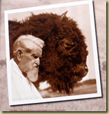

In 1996, the JA Ranch donated descendents of his original herd to Texas Parks and Wildlife, which in turn established them here at Caprock Canyons. One day, when I went to the park’s Visitor’s Center, I got to meet the Park Superintendent, Don Beard, and also the Bison Herd Manager, C. L. Hawkins. “C. L.” says there are 66 adults and 17 calves in the bison herd this spring. (Photo access to them is limited by extensive protective fencing. My apologies for the poor photo below.)

“C. L.” has cut from steel a collection of bison silhouettes in various sizes and positions which have been placed in several locations throughout this park. Extras were even donated to the City of Quitaque (pronounced “Kitty-kway”) for the gateway sign at the west side of town.
Look closely below and you’ll see a stream of bison moving from the left and up over the signage. Each is individually cut. There’s no real way to take a close up photo. The scale gets lost. It’s meant to be seen from a comfortable distance.

The City of Quitaque’s motto is “Hope, Pride, Progress”, which we found noble in light of its being a sleepy, dying little village.
An interesting note about the park’s bison herd: Ted Turner, who raises bison, donated 2 bulls hoping to increase the genetic pool of the park’s herd. The two Turner bulls were allowed to breed with 2 cows from the park’s herd. As a result, it was discovered that there are two genetically different bison herds in this country: a northern (Turner’s are examples) and a southern strain (Goodnight’s herd). So, in order to preserve the purity of the Goodnight herd genetics, the Turner bulls from the northern strain could not be allowed to breed freely with these bison from the southern strain, nor could their two male “test” offspring. The four bulls live a fine life in a large canyon below the park’s Visitor’s Center. They are often visible from there, and will spend the rest of their days isolated from the remaining herd. The latter is located in a large pasture just to the east of the park’s main entrance.
We toured the park by road and by foot on the Canyon Rim Trail, accessible from the campground.

Here are more pix of this beautiful place:


A view out the trail from the Quitaque depot. 
A bit further out is this metal gateway (below):

If you turn 180 degrees, looking back across the road, you can see where the trail came from (below). 
This trailway looks like you’d rarely, if ever, encounter another hiker/bicycler/equestrian. Great for some time to unwind, watch wildlife, see the countryside!
I could post a lot more pictures but hope these few will encourage you to visit Caprock Canyons State Park and Trailway.
Subscribe to:
Posts (Atom)