Showing posts with label Wildflowers. Show all posts

Saturday, June 5, 2010

Alaska 2010 – May 15 to 19: Caprock Canyons State Park & Trailways, Quitaque, TX

Caprock Canyons State Park and Trailways

We drove up from Matador, TX, arrived safely, and got set up for a four-night stay. We really want to see as many Texas State Parks as we can; Texas has so much to offer in its diversity. Our winter home is actually on an enormous river delta created over thousands of years by the Rio Grande River, so it’s very flat. Exploring this part of the Texas Panhandle brought us lots of surprises! Deep canyons, hills, and the most beautiful red rock this side of Sedona, AZ. And more wildflowers! They were gorgeous; highlights are shown below.

We’d hoped to visit Palo Duro Canyon State Park which is not far from here. Because it’s so deep and dramatic, Palo Duro’s been described as the “Grand Canyon of Texas”. However, we came here to Caprock because, with the recent rain, we’d heard the roads through Palo Duro were blocked off due to water over the roads. Of course, after we set up here, reports from Palo Duro were that the roads were fine, that the water had subsided. Oh, well, another trip!

What a wonderful place this Caprock Canyons is! The rich colors of the canyons and dramatic shapes of promontories!

TX-Quitaque-CaprockCanyonsSP-9

Yucca and so many kinds of wildflowers were in bloom. The campground is well-laid out, each site having a wind/sun shelter, lantern hook, and grill. The recent rains had produced a bumper crop of mosquitoes which was the only real negative.

TX-Quitaque-CaprockCanyonsSP-YuccaBloomP5152027

Cactus in bloom:

P5182120

A close-up of a cactus bloom:

TX-Quitaque-CaprockCanyonsSP-CactusBloom

Look closely and you’ll see a green-looking bee inside this cactus bloom:

P5182117

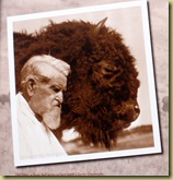
Charles Goodnight TX-Quitaque-CGoodnight&Friendwas a cattle baron and rancher during the days of the huge cattle drives up from Texas to Kansas and other markets. The Goodnight-Loving Trail was named in part after him. Goodnight had owned enormous tracts of land (including the JA Ranch referenced in the next photo), fenced it for his cattle, but understood the importance of free-ranging bison, the original inhabitants of this land. He fostered his own herd of bison in order to preserve them.

TX-Quitaque-CaprockCanyonsSP

In 1996, the JA Ranch donated descendents of his original herd to Texas Parks and Wildlife, which in turn established them here at Caprock Canyons. One day, when I went to the park’s Visitor’s Center, I got to meet the Park Superintendent, Don Beard, and also the Bison Herd Manager, C. L. Hawkins. “C. L.” says there are 66 adults and 17 calves in the bison herd this spring. (Photo access to them is limited by extensive protective fencing. My apologies for the poor photo below.)

P5182104

“C. L.” has cut from steel a collection of bison silhouettes in various sizes and positions which have been placed in several locations throughout this park. Extras were even donated to the City of Quitaque (pronounced “Kitty-kway”) for the gateway sign at the west side of town.

Look closely below and you’ll see a stream of bison moving from the left and up over the signage. Each is individually cut. There’s no real way to take a close up photo. The scale gets lost. It’s meant to be seen from a comfortable distance.

P5182154

The City of Quitaque’s motto is “Hope, Pride, Progress”, which we found noble in light of its being a sleepy, dying little village.

An interesting note about the park’s bison herd: Ted Turner, who raises bison, donated 2 bulls hoping to increase the genetic pool of the park’s herd. The two Turner bulls were allowed to breed with 2 cows from the park’s herd. As a result, it was discovered that there are two genetically different bison herds in this country: a northern (Turner’s are examples) and a southern strain (Goodnight’s herd). So, in order to preserve the purity of the Goodnight herd genetics, the Turner bulls from the northern strain could not be allowed to breed freely with these bison from the southern strain, nor could their two male “test” offspring. The four bulls live a fine life in a large canyon below the park’s Visitor’s Center. They are often visible from there, and will spend the rest of their days isolated from the remaining herd. The latter is located in a large pasture just to the east of the park’s main entrance.

We toured the park by road and by foot on the Canyon Rim Trail, accessible from the campground.

Map picture

Here are more pix of this beautiful place:

P5162090
TX-Quitaque-CaprockCanyonsSP-10
P5162069 P5182108 P5182127 Just outside the state park, there’s a 64-mile-long multi-purpose trailway ("Rails-to-Trails") for hikers, bikers, and equestrians which has “depots”P5182144 or access points sprinkled along its length. One of these “depots” is in Quitaque, not far from the park. We didn’t get a chance to ride this Trailway but here are pictures.

A view out the trail from the Quitaque depot.
P5182147

A bit further out is this metal gateway (below):

P5182149

If you turn 180 degrees, looking back across the road, you can see where the trail came from (below).
P5182152
This trailway looks like you’d rarely, if ever, encounter another hiker/bicycler/equestrian. Great for some time to unwind, watch wildlife, see the countryside!

I could post a lot more pictures but hope these few will encourage you to visit Caprock Canyons State Park and Trailway.

Monday, May 31, 2010

Alaska 2010 – Day 4, Kerrville, TX, & Hill Country Tour

On Sunday, May 9, our friends/neighbors from Retama Village down in Mission, TX, Doug & Laura Mayer, arrived to spend a couple of days at Buckhorn Lake RV Resort and to play some golf with other Retama neighbors, Ken & Sue Gambrell (who’d also arrived Sunday and will stay for the summer). Great to see them all!

We’d been looking forward to a visit with the Mayer’s. Life in Retama gets full and busy; this was a great opportunity to just hang out. The four of us decided to take a drive up the Guadalupe River; locals had said it would be a beautiful drive. It became an extraordinary tour of the Texas Hill Country. The Guadalupe is a very important watershed and water source for this central part of Texas. There’s also a lot of history to the communities which sprang up along its banks dating back to the early settlers and to the days of the huge cattle drives.

We headed west-southwest along the river from Kerrville. It developed into a fascinating loop tour! The countryside along our route was stunning. It was indeed the Hill Country – limestone hills (almost mountains!) and cliffs, sweeping vistas no camera could capture, cool green along the river, ranches, and a significant number of “game farms” where exotic deer, for example, are provided for “canned” hunts.

Each game farm has very high specialized fencing to keep the exotic wildlife IN; and white-tail deer are so common in this area, cattle ranchers sometimes use this fencing around their fields to keep deer OUT!

There were also many goat farms, so many as to pique our curiosity – were they grown for their milk (therefore artisan cheese-making)? Hmmm. Granted, they’re hardy creatures so can survive in this rocky country with its thin soil.

We did see a lovely herd of longhorn cattle. If they don’t typify the Great State of Texas, what does???

P5101935

P5101938

And wildflowers, such beautiful wildflowers, just covering the roadsides! Drifts of yellow, with bits of orange, and balanced by clumps of white, lavender and even burgundy. Fresh spring greens in many shades. A visual feast!

P5102101

TX-Kerrville-WildflowerBouquet

We kept seeing a striking burnt orange flower with yellow tips. (There are some in the picture above.) There were huge spreads of these here and we later saw them all the way up through the Texas Panhandle; I found them intriguing! They are called “Indian Blankets” or Fire Wheels”. Here are a couple of close-ups:

TX-Kerrville-IndianBlanket

P5162085

During our tour, we kept crossing the extremely curvy Guadalupe (known by many locals as the “Guadaloop”). Each crossing has a specific name as you’ll see by just these two examples:

P5101920 P5101921

(So who were the Smith’s?!?) The number of river crossings was amazing! Each one is named and helps to identify where you are or where you live.

Just past River Inn Crossing, south of Hunt, TX, on Highway 39 southwest of Kerrville, is the “Boot Hill Ranch”. We HAD to stop for pictures! How refreshing to see such whimsy! There was about an eighth or quarter of a mile of fence posts topped with boots, every possible kind of boot in every possible color!

P5101891

P5101893

Continuing on, the banks of the Guadalupe are lined with cabins, church camps, and weekend homes. This area is within an hour-and-a-half or two hours of San Antonio. It would be feasible time-wise to escape to a riverfront place here or one of the large homes up on a nearby hilltop or ridge spine.

Texas has a remarkable collection of state parks, expressing the diversity of this huge state. We toured Lost Maples State Park and it is no exception…a great place for hiking, wildlife viewing, and has a small campground with many long, level sites. It was lunch-time; conveniently a volunteer in the park’s Visitor’s Center was able to recommend a small Mexican restaurant, Mama Chole’s, in Leakey (“Lakey”), just down the road. It was very, very good! I would definitely recommend it if you’re touring in the area.

TX-Kerrville-MamaChole'sInLeakey

We saw country today that many visitors might not see while touring the Hill Country. What a special day it was! Great friends, spectacular scenery!